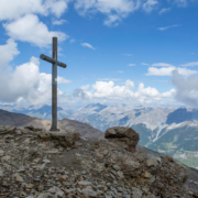
Cima – Sobretta Cross
Sunny Valley – Dell’Alpe Pass – Mot De Li Leur – Term Plan
Alpine Bridge – Alpine Valley – Sunny Valley
Sunny Valley – Malga Dell’Alpe
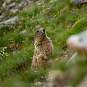
Marmot Route

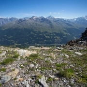
Sobretta Ridge – Sunny Valley
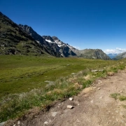
Loop route starting and ending at Sunny Valley, an enchanted plateau, sunny in both summer and winter, and crowned by the most important peaks of Alta Valtellina, including Pizzo Tresèro and Cima Sobretta.
The trail, suitable for hiking, is of medium difficulty with some steep downhill sections (maximum 204 m).
This route is rather short; in fact, the average travel time is 1 hour and 20 minutes.
By starting the walk in the morning, it is then possible to arrive on time for lunch at the typical Sunny Valley restaurant and enjoy a well-deserved Valtellina meal.
During the trek it will be possible to see, in that order, the magnificent Valfurva Canyon and the beautiful Edelweiss cave dedicated to edelweiss.
Thanks to the Sunny Valley – Canyon – Edelweiss Cave trekking circuit, you can spend a day outdoors among the unspoiled wilderness of Stelvio National Park.
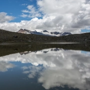
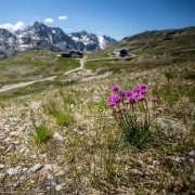
Sunny Valley – Alp Pond
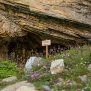
Sunny Valley – Canyon – Edelweiss Cave
Loop route starting and ending at Sunny Valley, an enchanted plateau, sunny in both summer and winter, and crowned by the most important peaks of Alta Valtellina, including Pizzo Tresèro and Cima Sobretta.
The trail, suitable for hiking, is of medium difficulty with some steep downhill sections (maximum 204 m).
This route is rather short; in fact, the average travel time is 1 hour and 20 minutes.
By starting the walk in the morning, it is then possible to arrive on time for lunch at the typical Sunny Valley restaurant and enjoy a well-deserved Valtellina meal.
During the trek it will be possible to see, in that order, the magnificent Valfurva Canyon and the beautiful Edelweiss cave dedicated to edelweiss.
Thanks to the Sunny Valley – Canyon – Edelweiss Cave trekking circuit, you can spend a day outdoors among the unspoiled wilderness of Stelvio National Park.
Santa Caterina Valfurva, freedom at high altitude
![]()
![]()
![]()
DISCOVER SANTA CATERINA
INFORMATION
S.C.I. SPA
S.C.I. SPA